
Lillooet - August 7,8
We drive east on Highway 16 from Prince Rupert to Prince George, then travel south on 97 making stops along the way Friday and Saturday. On Sunday (7th), we get to the junction of Hwy. 99. Here we turn west, a route we’ve never traveled.
Almost immediately the scenery changes. The hills grow higher, the valleys deeper and more precipitous. Soon we’re driving through scenes that remind us a lot of the badlands around Drumheller (Alberta). But it gets more drastic. On pull-off after pull-off we stop the car to snap pictures of amazing ravines with the muddy river below. I believe we are following the Fraser River.
We arrive in Lillooet in the sweltering mid-afternoon. We revel for a while in our cool air-conditioned room before scuttling off to find a store and food for dinner plus cinnamon roll biscuits for coffee time (ah the joys of air-conditioning that make even hot coffee perfectly comfortable on a scorching afternoon).
We finally venture out around 6, when we hope the air will have begun cooling (it is still debilitatingly hot). We walk down main street, and find the Mile 0 cairn, the Miyazaki House ("Gingerbread look" says the guidebook) and the Camel Barn. Of the Mile 0 cairn, our glossy Lillooet mag explains:
The Mile 0 cairn was erected in 1939, marking Mile 0 of the old Cariboo Road. From this point in the early stage coach days, all road houses and stopping places from here to Barkerville were known by their mileage from Lillooet - 70 Mile, 100 Mile etc. In 1858 Governor James Douglas ordered the construction of a trail from Fort Douglas on Harrison Lake to Lillooet. The Royal Engineers supervised the construction and miners with picks and shovels contracted to build the road for the sum of five English pounds each, which they received upon arrival, by land and portage at Lillooet.
(I’m thinking the terrain around Lillooet in both directions is so incredibly mountainous, the valleys so steep, the rivers cutting those valleys so swift and treacherous, the feat of building a road through it with picks and shovels is almost unbelievable.)
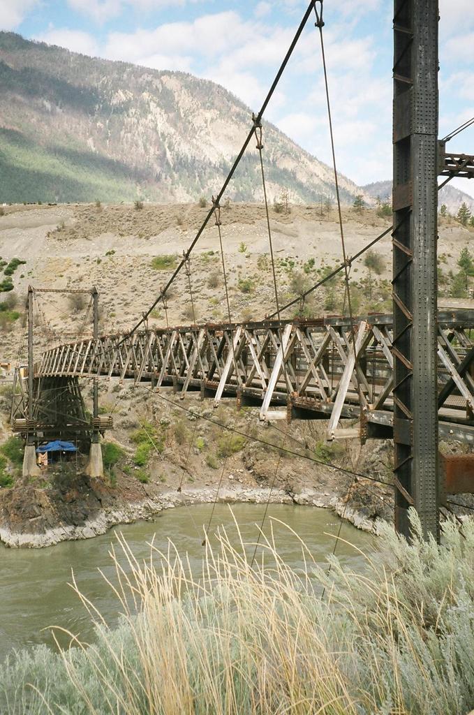
At the end of main street, we come to a beautiful suspension bridge – called by locals "The Old Bridge." It was built in 1913. From the bridge we look down on fishing camps. From our guidebook:
"In August the banks of the Fraser are dotted with fish drying camps.Pole racks are roofed with boughs for circulation of the dry solar heat, driven at this time of the year by searing river winds. Salmon was the mainstay of the First Nations in the Lillooet area...."

On our walk back through town, we admire the jade sculptures which dot the main street, culminating in four large pieces outside the former St. Mary the Virgin Church (now the Visitor Center). Our guidebook tells us:
Lillooet’s past is forever linked to B.C.’s gold rush era but its future is definitely green – jade green.
[...]Tuemp’s (Erdmann Tuemp is one of the coordinators of Lillooet’s Jade Project) fascination with jade is in its intrinsic beauty. "If you love art, you’ll love jade." he says. "The beauty is so different from one piece to another. That’s why the theme for the park is 'The Many Faces of Jade.' Each stone is like an abstract painting, the colors, shapes and fractures all have different qualities.
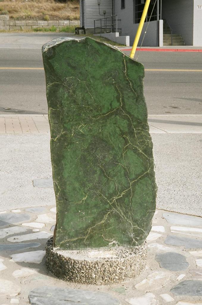
(Other facts about jade: It’s B.C.’s official gemstone, the traditional gift for a 35th wedding anniversary, B.C. is considered to have the largest deposits of ‘nephrite’ – one of two types of stones called ‘jade’ – in the world, local First Nations made used jade to make tools and weapons, and is the most important gemstone in China).
I take this picture Monday morning, when the light is right, and just before we leave on the final leg of our journey – the Sky to Sea Highway (normally called ‘Sea to Sky’ - but we’re going the other way) and home.


0 comments:
Post a Comment